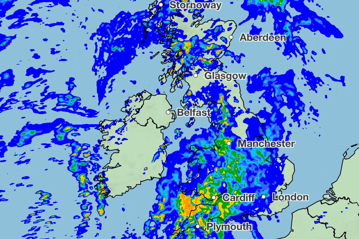
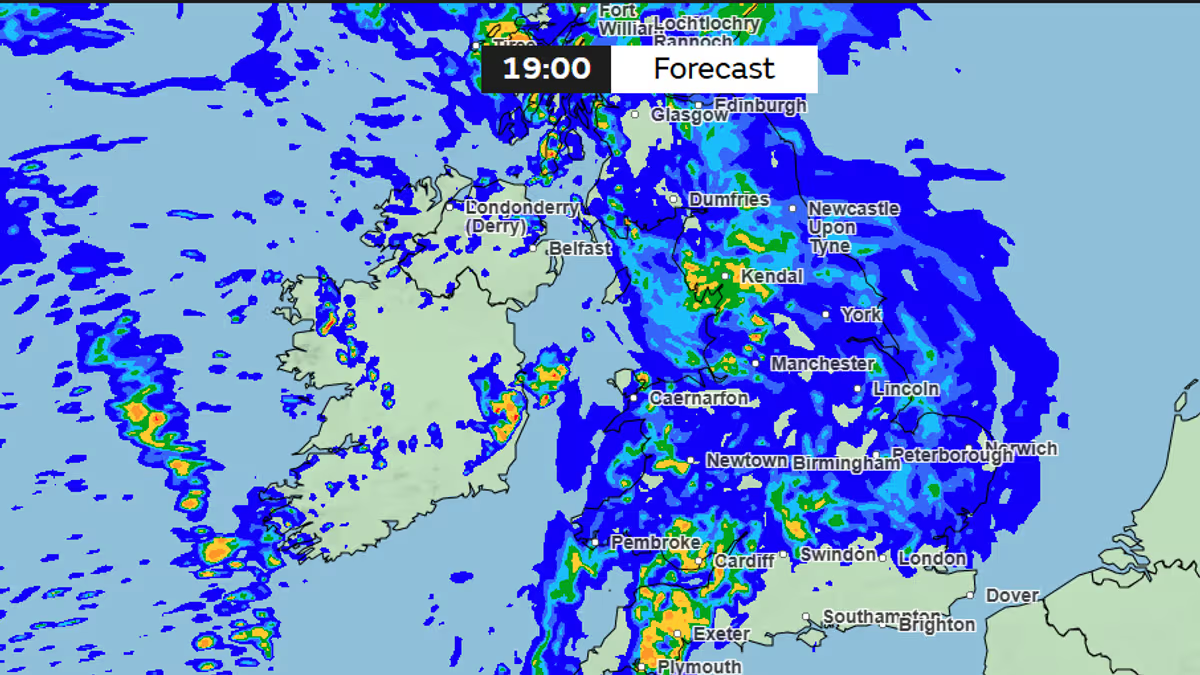
The UK has been basking in sunny weather this weekend, but latest weather maps show heavy rain could be on the cards as we head into the start of June21:04, 24 May 2026Britain has enjoyed glorious sunshine this weekend, but the warm spell could be about to come to a sudden halt.The latest weather maps from WXCharts indicate torrential rain is set to batter parts of the British Isles next Sunday (May 31), with up to 15mm expected to fall in certain areas. According to the maps, a swathe of rain will sweep in at around 12am, stretching from Plymouth through Wales and into Lancashire, striking Manchester and Liverpool, as well as parts of northern England and Scotland.The South East will also be lashed by heavy rainfall simultaneously, with the maps indicating downpours of up to 4mm per hour. The rain will then persist throughout the day, with the North West and Scotland braced for the heaviest downpours at 6pm on Sunday.READ MORE: 'Historic' UK heatwave could see 35C smashing all-time records on Bank Holiday MondayREAD MORE: NHS and Met Office issue Sunday alert and urge everyone to follow 'two hour rule'The maps reveal up to 2mm of rain falling in Plymouth at 12am next Sunday, while the whole of Wales can anticipate downpours of up to 1mm per hour. Parts of Lancashire and the North West face slightly heavier rainfall, with up to 2mm per hour forecast.Parts of Scotland, including Edinburgh, Stirling, Glasgow and Falkirk, are also set to be drenched at the same time. Meanwhile, London and the South East can brace for showers falling at a rate of up to 4mm per hour.The rain will gradually clear from most regions as the afternoon progresses. However, large swathes of Scotland, including Glasgow and western areas, can expect further rainfall at 6pm next Sunday. An accumulative precipitation map shows 8mm of rain in southwest Scotland by 12am on Monday, June 1. Meanwhile, parts of the Scottish Highlands could see a 15mm accumulation of rain by the end of the day on Sunday, reports the Express.Alongside the rainfall, temperatures are also set to plummet across the UK. This follows the Met Office recording temperatures of 30.5C in Kent on Saturday (May 23), marking the hottest day of the year so far and beating the warmest May temperature recorded in the UK since 2012.While further warm spells are anticipated on Bank Holiday Monday and throughout the coming week, the mercury could take a sharp nosedive at the close of next weekend. Weather maps from WXCharts indicate lows of 3C in central Scotland at 6am on Monday, June 1.In England, temperatures could drop as low as 12C in London and Manchester at the same time. Meanwhile, Plymouth could see it fall as low as 10C while Newcastle is forecast for lows of 11C.The chillier temperatures will persist throughout the morning on Monday, June 1, with maps revealing lows of 14C in London by midday. Most of England could experience similar conditions while the mercury could plunge as low as 4C in Scotland.Separately, in its long-range forecast for the UK, covering Friday, May 29 until Sunday, June 7, the Met Office is predicting some heavy rainfall across the nation. The forecast also anticipates increasingly unsettled conditions as we head into June. The forecast states: "The south of the UK is expected to be mainly fine and dry at the start of this period, with temperatures well above normal. It will be cloudier in the north with some rain at times, this heavy in places.Article continues below"Moving into early June, conditions will likely become unsettled across the UK as a whole. Atlantic weather systems will move in from the west bringing showers or longer spells of rain at times."The rain will likely be heaviest in parts of the west and northwest. Temperatures will probably be near normal."
Horror maps show exact areas forecast mega downpours as 7-day heatwave ends
The UK has been basking in sunny weather this weekend, but latest weather maps show heavy rain could be on the cards as we head into the start of June
643 words~3 min read