Since the start of spring, unsettled weather has been a regular visitor in the Plains and Midwest — and that pattern isn’t letting up anytime soon.
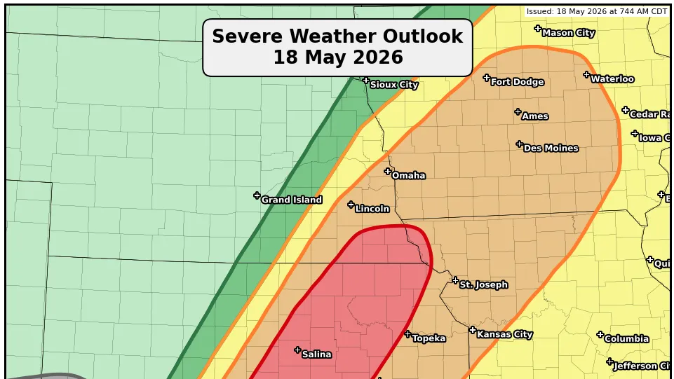
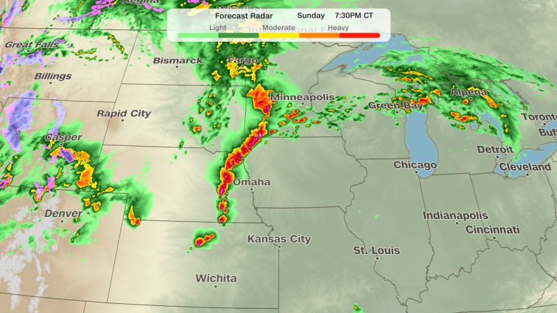
Thunderstorms are gearing up to roll through the Southern Plains and North Texas starting this afternoon. These areas are where the storms will really pack a punch, with the potential for large hail, gusty winds, and a few isolated tornadoes. Elsewhere, storms may pop up here and there, but they’ll be more scattered and less intense.
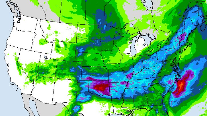
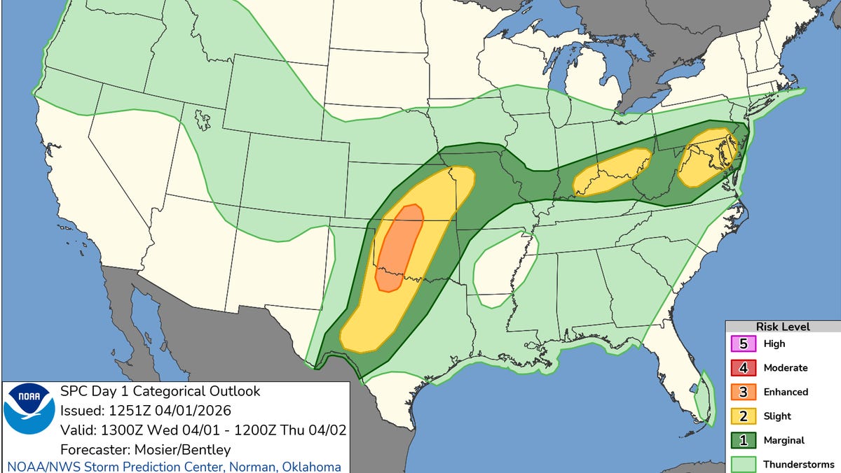
A national map shows more than 30 states with at least a chance of thunderstorms, highlighting just how widespread this system is. Thunder, heavy rain, hail and damaging winds are possible across the Plains, Midwest, Southeast and Northeast through early Thursday, April 2. A few tornadoes are possible.
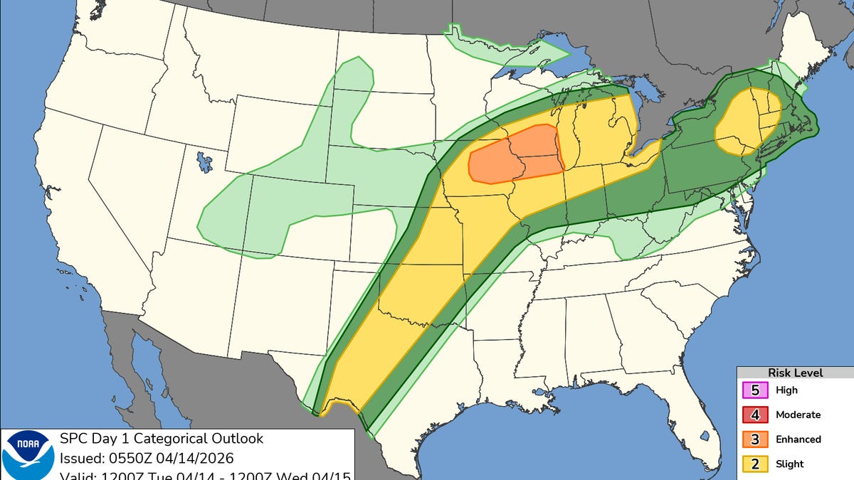
The broad footprint of this weather pattern comes from multiple storm systems and fronts interacting across the country. One system pushing out of the Rockies and across the Plains will help fuel thunderstorms from Texas into the Midwest and Ohio Valley, while another frontal boundary and disturbance spreading into the Northeast and Mid‑Atlantic will support scattered storms there.
NOAA’s climate outlook also points to above-normal precipitation across much of the Lower 48 early this week, which fits with the expected widespread thunderstorm chances.