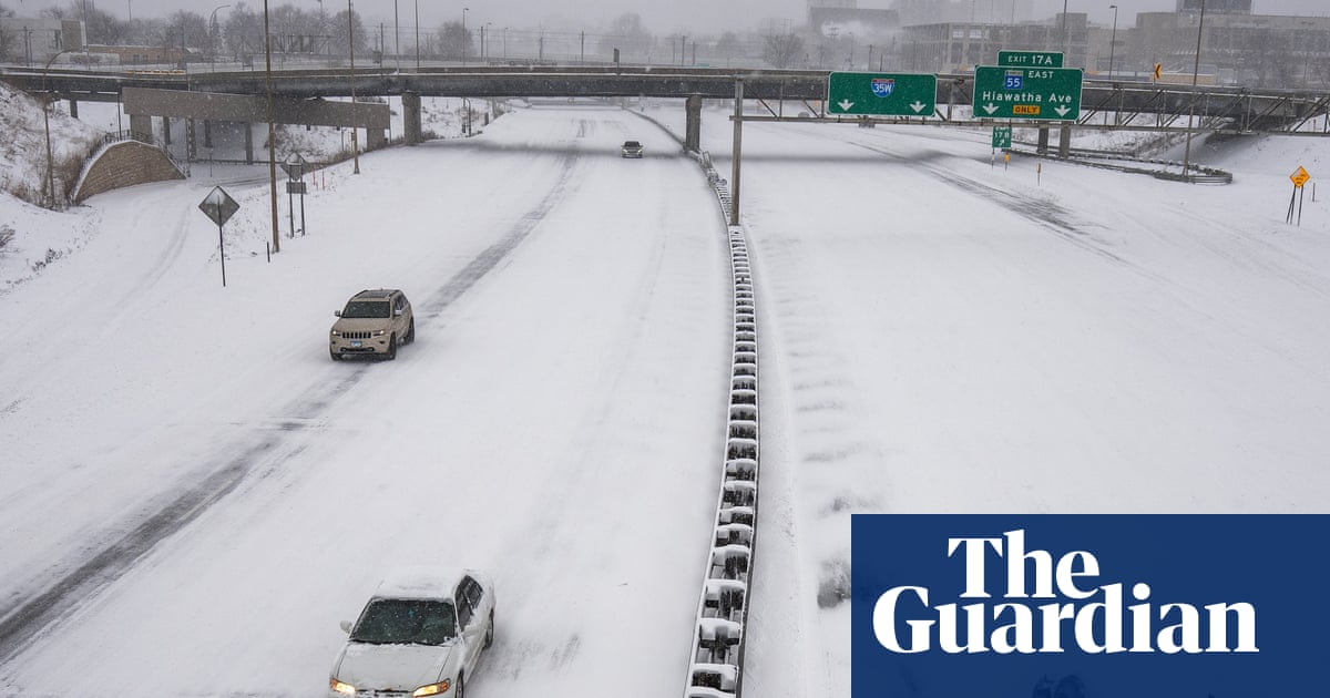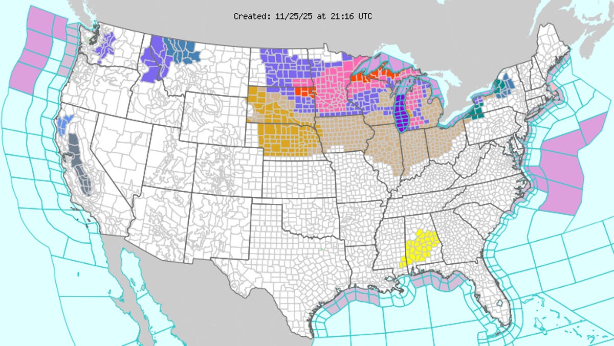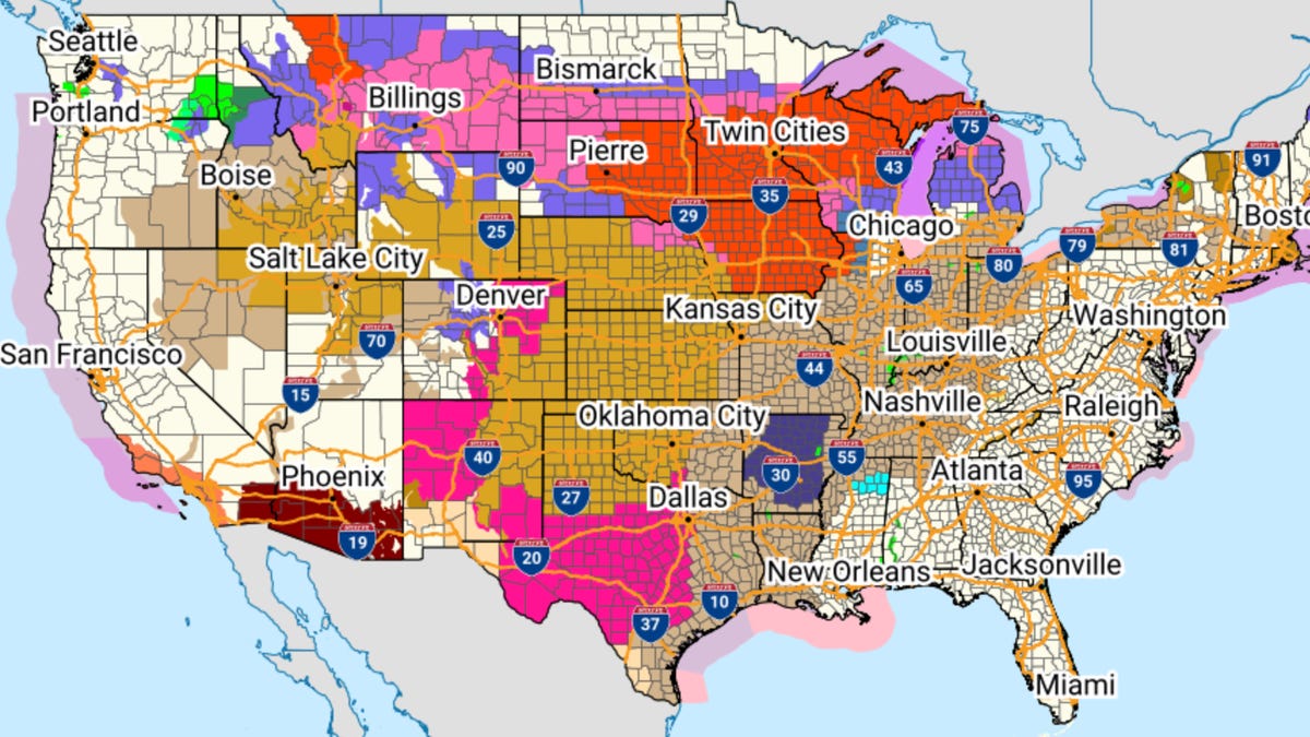
A major winter storm is moving across the northern United States, bringing a mix of heavy snow, ice and blizzard conditions from the High Plains through the Great Lakes. Forecasters say the storm could produce record or near-record snowfall in parts of the Upper Midwest.
The hardest-hit areas are expected to include northern Wisconsin, the Upper Peninsula of Michigan and portions of Minnesota, where snow totals could reach 2 to 4 feet in some high terrain locations. Strong winds will create widespread blizzard conditions, with near-zero visibility and dangerous travel across a large portion of the region.
Snowfall will be heaviest Sunday and Monday, with embedded bands of snow producing rates of 1 to 3 inches per hour in some areas. The combination of heavy snow and gusty winds could also lead to power outages, roof collapses and long-lasting impacts on travel and daily life.
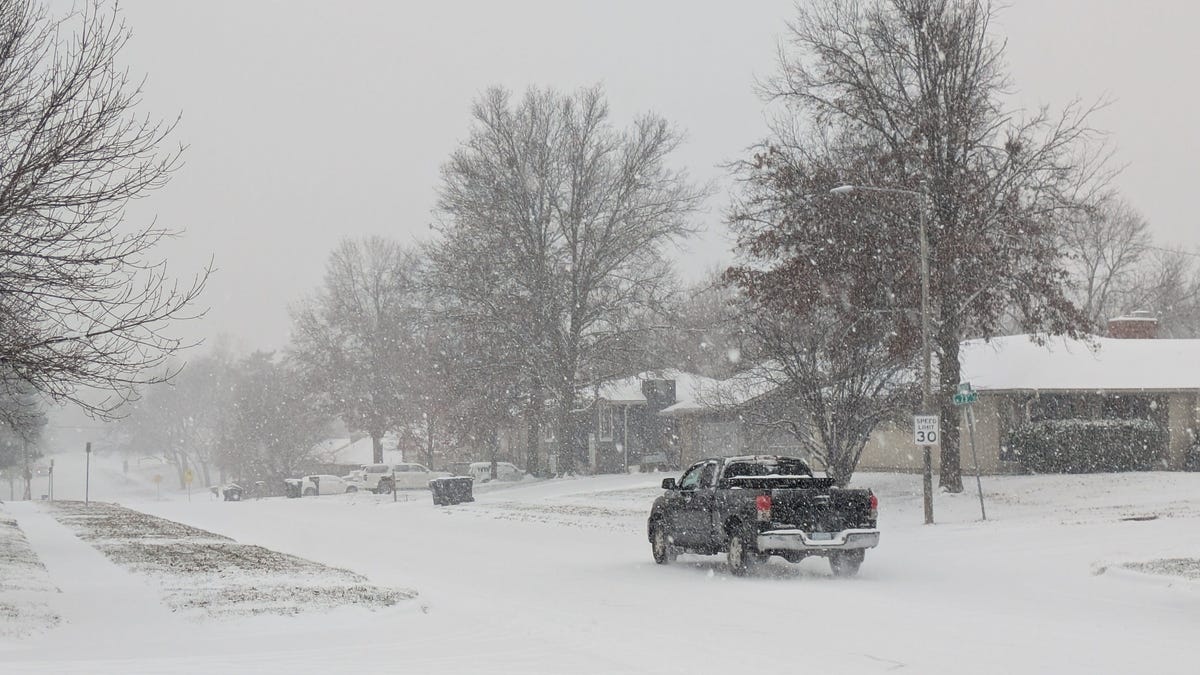
Further south, parts of the Northern High Plains and central Midwest are seeing a mix of snow, sleet and freezing rain. Ice accumulations may make roads slick, while lighter snow totals will still cause travel difficulties and drifting snow as winds pick up.
More: Huge 'megastorm' will sweep US with dangerous weather, forecast says