Show Caption
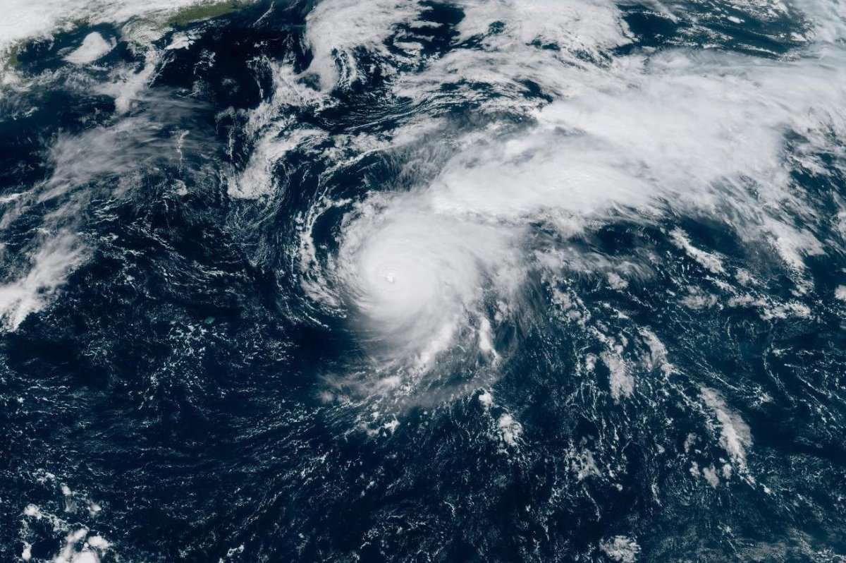
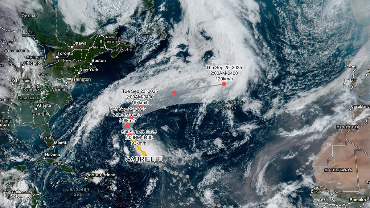
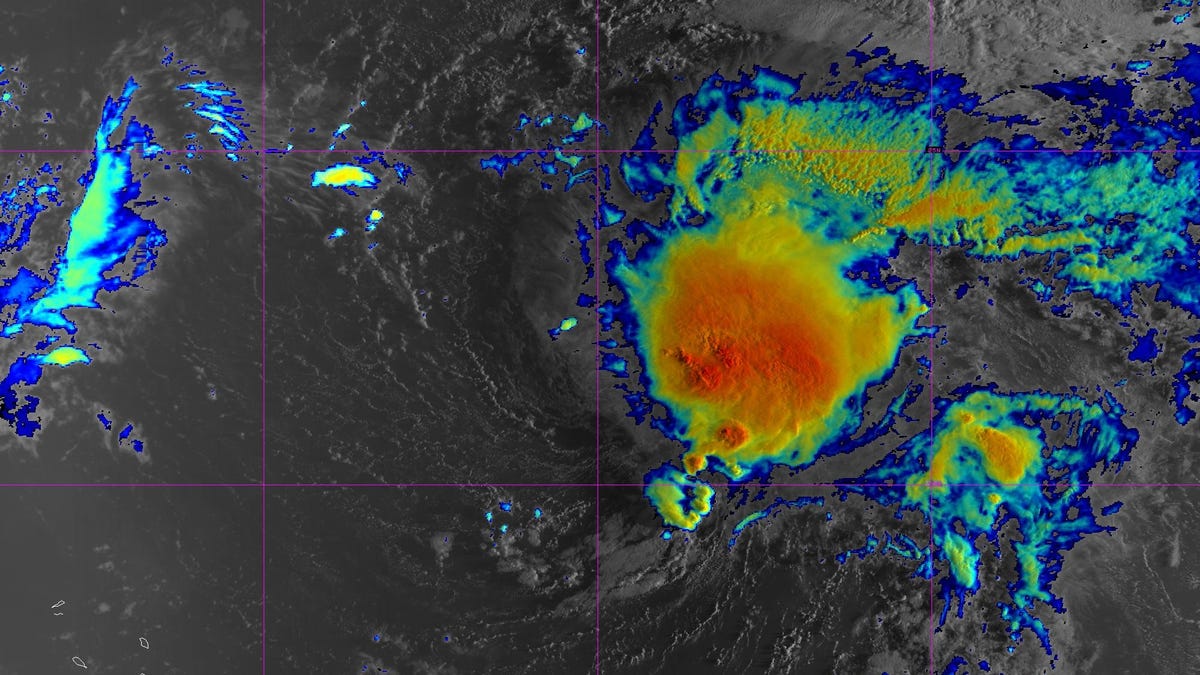
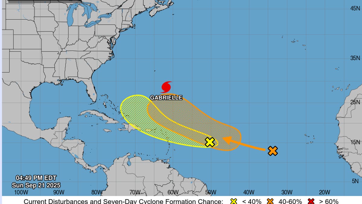
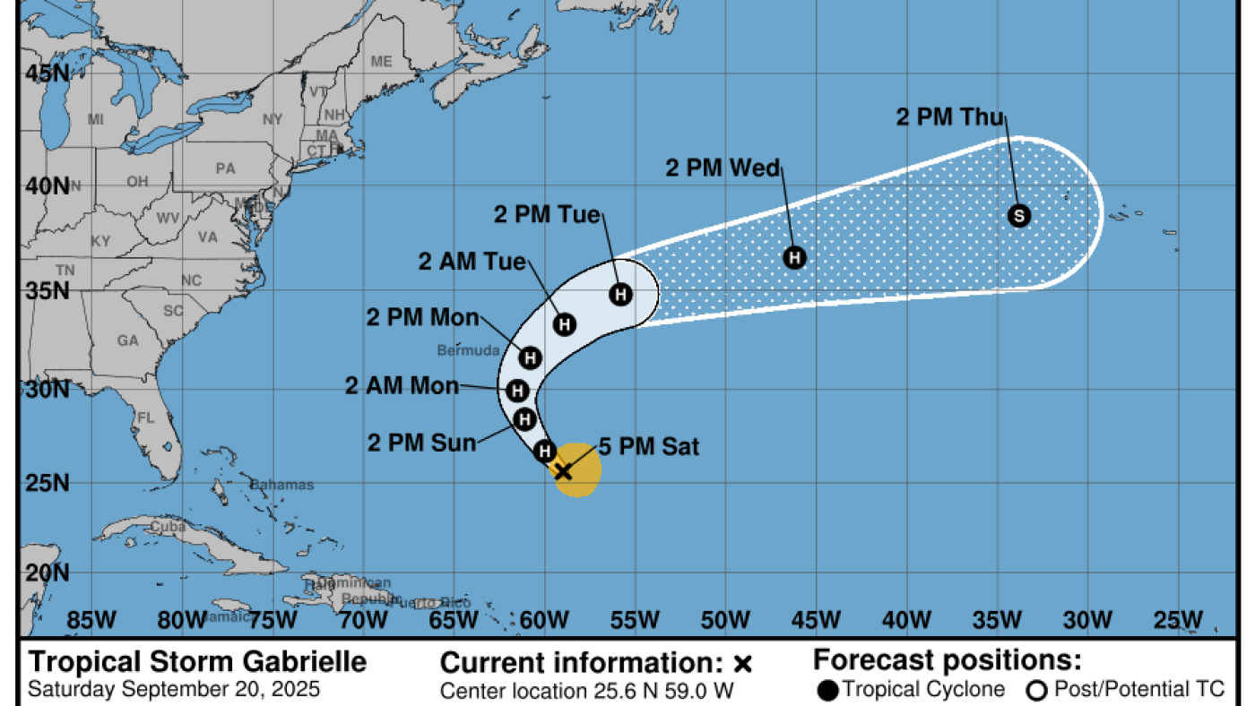
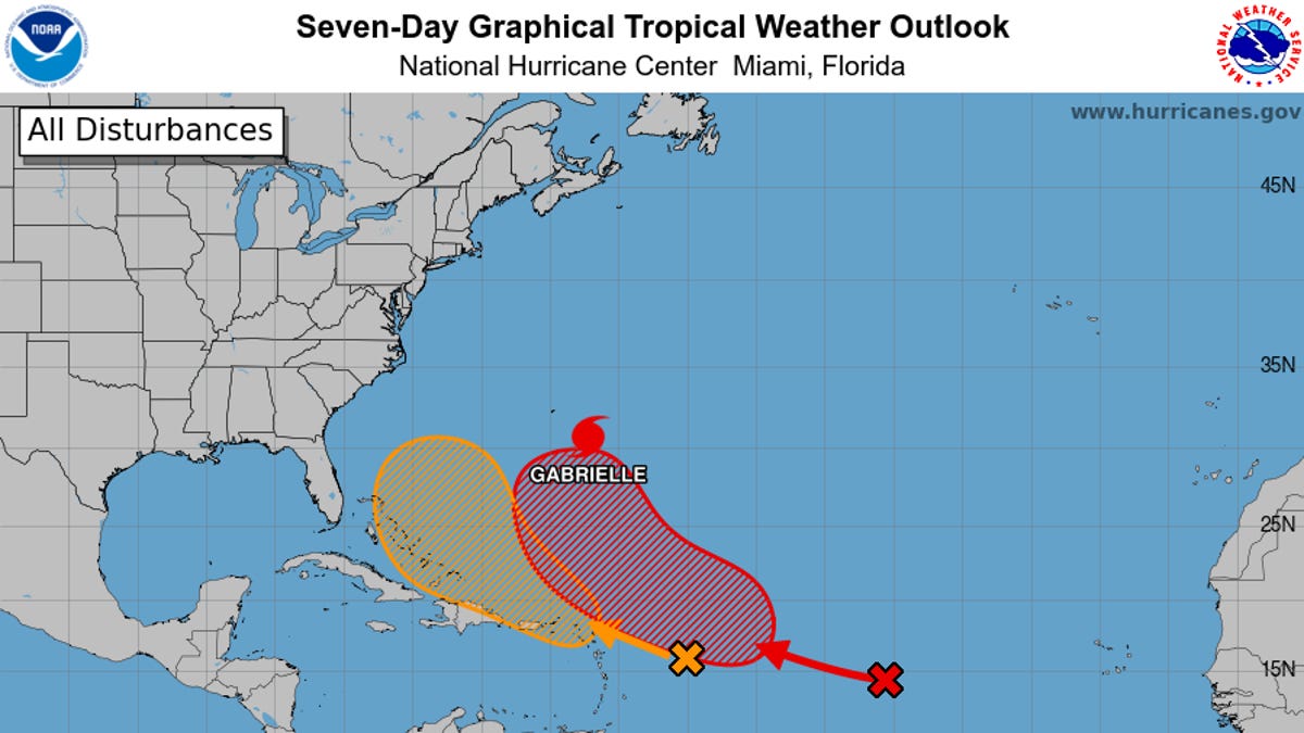
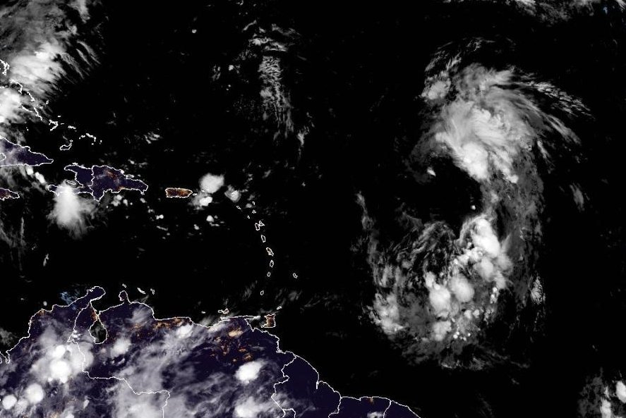
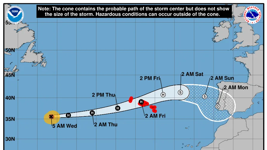
Editor's Note: Track the latest with Hurricane Gabrielle for Thursday, Sept. 25.Hurricane Gabrielle continues to pick up strength in the Atlantic and move away from the U.S. towards Portugal and Spain.The hurricane, now a Category 3, is expected to reach the Azores, an autonomous region of Portugal in the mid-Atlantic, late on Thursday, according to the National Hurricane Center. The Meteorological Service of Portugal issued a hurricane warning for the islands.Forecasters said in an early morning advisory on Sept. 24 that Gabrielle was located about 1,360 miles west of the Azores, with maximum sustained winds of 115 mph.The storm is forecasted to dissipate early Saturday morning, before it reaches Portugal early Monday morning.The storm's path has shifted away from the U.S., so there are currently no coastal watches or warnings in effect; however, swells generated by the hurricane will still impact Bermuda.The swells are also expected to reach the east coast of the U.S. from North Carolina northward, as well as Atlantic Canada, and are expected to continue through the early part of this week, forecasters said. These swells are likely to cause life-threatening surf and rip current conditions."These swells are expected to produce life-threatening surf and rip current conditions," the NHC stated in an advisory.Hurricane Gabrielle trackerThis forecast track shows the most likely path of the center of the storm. It does not illustrate the full width of the storm or its impacts, and the center of the storm is likely to travel outside the cone up to 33% of the time.Hurricane Gabrielle spaghetti modelsIllustrations include an array of forecast tools and models, and not all are created equal. The hurricane center uses only the top four or five highest-performing models to help make its forecasts.NHC tracking 2 more systems in the Atlantic, Tropical Storm Narda in the PacificGabrielle is not the only tropical activity in the Atlantic Ocean, according to the NHC.Forecasters said they are also keeping a close eye on two disturbances, one located in the central tropical Atlantic, Invest 93L, and another in the Eastern Caribbean Sea, Invest 94L.93L is moving west-northwestward to northwestward and is located 700 miles east of the Leeward Islands, which are in the northeastern Caribbean Sea. The storm has an 80% chance of developing within the next 48 hours and a 90% chance of developing within the next seven days.The second disturbance, 94L, is expected to move west-northwestward at 15 to 20 mph, bringing heavy rainfall to Puerto Rico and the Virgin Islands on Wednesday, September 24, and across the Dominican Republic starting Wednesday night, according to the NHC. The storm has a 30% chance of developing in the next 48 hours and an 80% chance of developing in the next seven days.Meanwhile in the Pacific, Hurricane Narda has strengthened, but remains south of Baja, California.According to an early morning advisory on Sept. 24, the storm continues to move toward the west at 13 mph. There are no coastal watches or warnings in effect. The storm is expected to continue moving west over the next couple of days.How do hurricanes form?Hurricanes are born in the tropics, above warm water. Clusters of thunderstorms can develop over the ocean when water temperatures exceed 80 degrees. If conditions are right, the clusters swirl into a storm known as a tropical wave or tropical depression.A tropical depression becomes a named tropical storm once its sustained wind speeds reach 39 mph. When its winds reach 74 mph, the storm officially becomes a hurricane.Prepare now for hurricanesDelaying potentially lifesaving preparations could mean waiting until it’s too late. "Get your disaster supplies while the shelves are still stocked, and get that insurance checkup early, as flood insurance requires a 30-day waiting period," the National Oceanic and Atmospheric Administration recommends.Develop an evacuation plan. If you are at risk from hurricanes, you need an evacuation plan. Now is the time to begin planning where you would go and how you would get there.Assemble disaster supplies. Whether you’re evacuating or sheltering in place, you’re going to need supplies not just to get through the storm but for a possibly lengthy aftermath, NOAA said.Get an insurance checkup and document your possessions. Contact your insurance company or agent now and ask for an insurance checkup to make sure you have enough insurance to repair or even replace your home and belongings. Remember, home and renters insurance don’t cover flooding, so you’ll need a separate policy for those. Flood insurance is available through your company, agent or the National Flood Insurance Program.Create a family communication plan. NOAA says you should take the time now to write down a hurricane plan and share it with your family. Determine family meeting places and make sure to include an out-of-town location in case of evacuation.Strengthen your home. Now is the time to improve your home’s ability to withstand hurricanes. Trim trees and install storm shutters, accordion shutters, and impact glass, and seal outside wall openings.Julia is a Trending reporter for USA TODAY and covers all things Labubu and Pop Mart, scientific studies and trending news. Connect with her on LinkedIn, X, Instagram, and TikTok: @juliamariegz, or email her at jgomez@gannett.comGabe Hauari is a national trending news reporter at USA TODAY. You can follow him on X @GabeHauari or email him at Gdhauari@gannett.com.