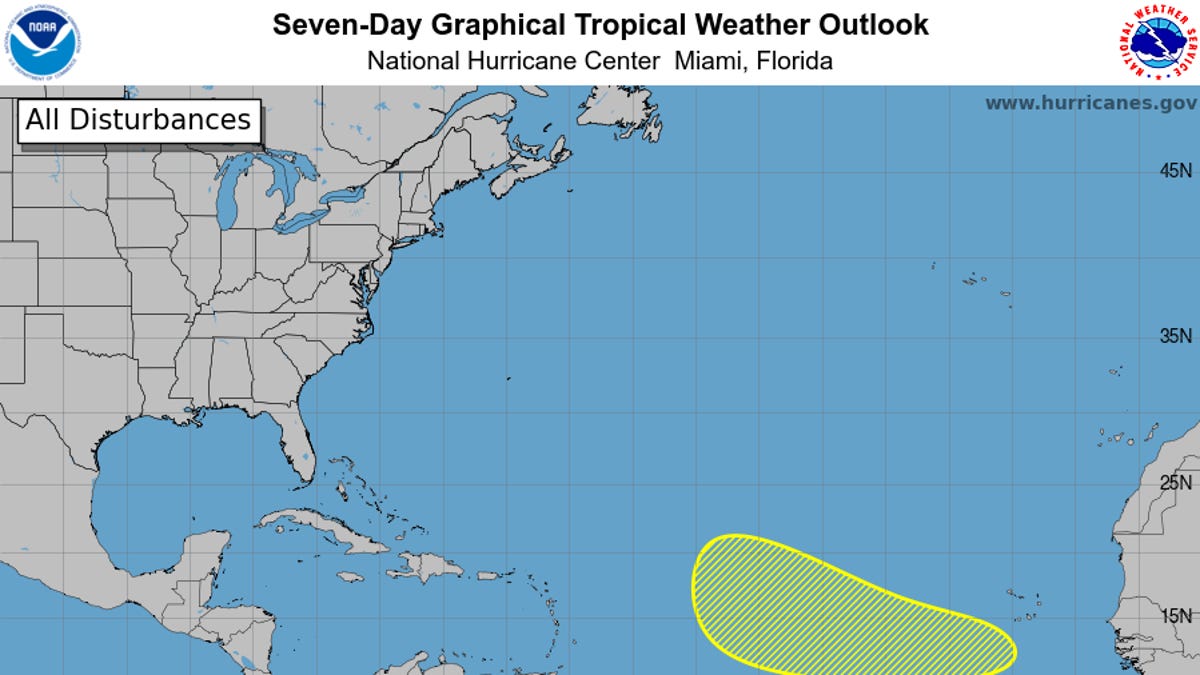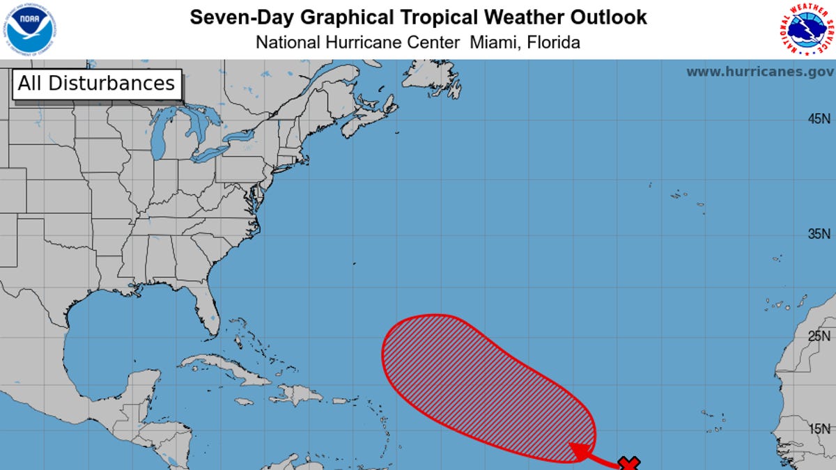
An area of thunderstorms in the Atlantic Ocean could be something to watch closely by Sept. 21, while in the Pacific Ocean, Tropical Storm Mario has risen like a phoenix from the ashes.
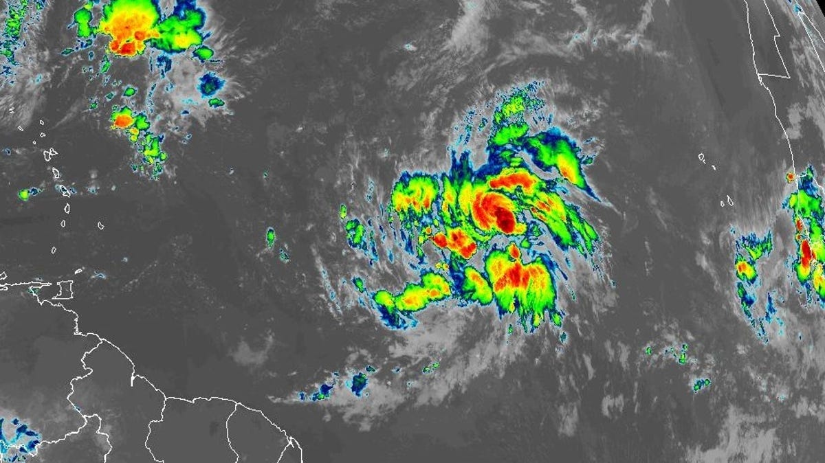
A storm in the eastern Atlantic would end what has been days of silence in the Atlantic, despite it being the typical peak of hurricane season. An area of disorganized showers and thunderstorms could gradually develop into a tropical depression, the National Hurricane Center said on Sept. 14.
The system is "likely to form during the middle to latter part of the week" as the area moves at 10 to 15 mph in a general direction toward the islands in the northeastern Caribbean, according to the center. If it becomes a tropical storm, the next name up in the 2025 storm name rotation is Gabrielle.
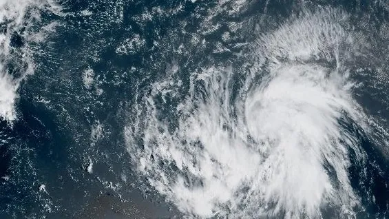
Mario had formed on Sept. 12, but by the evening of Sept. 13, the hurricane center reported Mario was no longer a tropical storm.
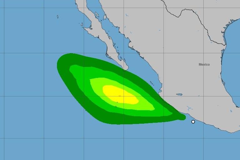
But by the afternoon of Sept. 14, the storm had regenerated with sustained winds of 45 mph off Mexico, about 20 miles east-northeast of Socorro Island and 280 miles south of the southern tip of the Baja California Peninsula. Mario, moving west-northwest at 7 mph, could strengthen to winds of 60 mph, but is not forecast to strengthen into a hurricane.